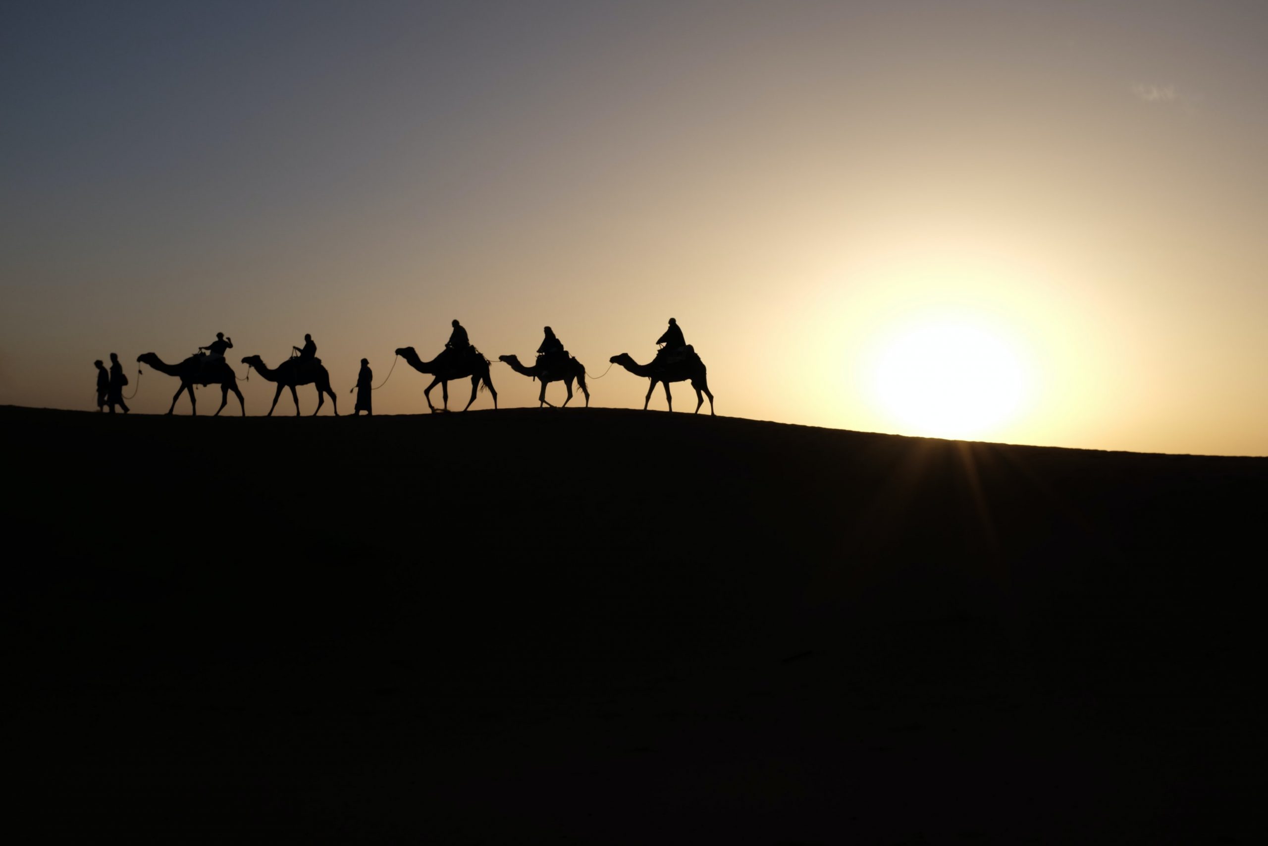
The Sahara is the vast desert that stretches across North Africa, from the Atlantic Ocean to the Red Sea. It is far more than endless sand: it has volcanoes, salt lakes, ancient rock art and a past when hippos swam in its lakes. Here are 17 facts about the Sahara Desert.
1The Sahara is the largest hot desert in the world.
It is not the largest desert overall. Deserts are defined by how little rain or snow they get, not by heat, so the frozen polar deserts of Antarctica and the Arctic are both bigger.
2It is about the same size as the United States.
The Sahara covers around 9.2 million square kilometres (about 3.5 million square miles) and stretches more than 4,800 kilometres (3,000 miles) from east to west. That is nearly 40 times the size of the UK.
3The Sahara has grown by about 10% since 1920.
A 2018 University of Maryland study of rainfall records from 1920 to 2013 found the desert had spread by around 10%, and by nearly 16% in summer. The researchers put about two thirds of this down to natural climate cycles and one third to climate change.

4“Sahara Desert” really means “desert desert”.
The name comes from the Arabic word sahra, which simply means desert. So calling it the Sahara Desert says the same thing twice.
5It covers nearly a third of Africa.
The Sahara reaches into Algeria, Chad, Egypt, Libya, Mali, Mauritania, Morocco, Niger, Sudan and Tunisia, as well as the disputed territory of Western Sahara.
6Only about a quarter of the Sahara is sand.
Sand seas and dunes, called ergs, cover roughly 25% of it. Most of the desert is bare rocky plateau, called hamada, along with gravel plains, dry valleys and salt flats.
7Some of its sand dunes are almost 150 metres high.
Star-shaped, pyramid-like dunes in the Sahara can reach almost 150 metres (500 feet), which is taller than the Elizabeth Tower that holds Big Ben.

8The highest point in the Sahara is a volcano.
Emi Koussi, in the Tibesti Mountains of northern Chad, rises to 3,415 metres (11,204 feet), more than two and a half times the height of Ben Nevis. The lowest point is the Qattara Depression in Egypt, 133 metres below sea level.
9The Sahara has a giant “eye”.
The Richat Structure in Mauritania, often called the Eye of the Sahara, is a set of rocky rings about 40 kilometres across. It is so large that it is easiest to see from space.
10Days are scorching but nights can be freezing.
Daytime temperatures can top 50°C between May and September. The dry air and clear skies let heat escape quickly after dark, so winter nights can fall to around -6°C, and snow has even fallen on the high mountains and on the desert’s northern edge.
11The Sahara’s famous heat record turned out to be a mistake.
For 90 years, El Azizia in Libya held the world record with 58°C, measured in 1922. The World Meteorological Organization later rejected it, finding that an inexperienced observer had used an unsuitable instrument. The official record is now 56.7°C, set in Death Valley, California, in 1913.
12Around 2.5 million people live in the Sahara.
Most live near oases, rivers and other sources of water, and some still follow a nomadic way of life with their herds. Peoples of the Sahara include Arabs, Berbers and the Tuareg, who are known as the “blue people” because of their indigo-dyed clothes.

13Gold and salt were once carried across it by camel.
For centuries, camel caravans crossed the Sahara carrying gold from West Africa northwards and salt southwards. Great West African empires such as Ghana and Mali grew rich by controlling and taxing this trade.

14The Sahara turns green roughly every 21,000 years.
A slow wobble in the Earth’s orbit, called precession, changes how much summer sunshine North Africa gets. When summers are stronger, the West African monsoon brings more rain, and the desert becomes savannah with rivers, lakes and animals such as hippos. The last green period ended around 5,000 years ago.
15Ancient rock art shows the Sahara’s wetter past.
At Tassili n’Ajjer in south-east Algeria, a UNESCO World Heritage Site since 1982, around 15,000 rock engravings have been found. Many show animals and people from times when the land was much greener.
16Sahara dust helps to feed the Amazon rainforest.
NASA satellite data shows that wind lifts about 182 million tonnes of Saharan dust out over the Atlantic each year. About 27.7 million tonnes land on the Amazon basin, bringing around 22,000 tonnes of phosphorus, a nutrient that plants need.
17Saharan dust sometimes reaches the UK.
When big dust storms in the Sahara meet southerly winds, the dust can be carried all the way to Britain. It can turn skies orange, and when it falls with rain it leaves a reddish film on cars, known as “blood rain”. This happened in March 2022.
FAQs about the Sahara Desert
Is the Sahara the biggest desert in the world?
No. It is the largest hot desert, but the polar deserts of Antarctica and the Arctic are bigger. The Sahara is the third largest desert overall.
How many countries is the Sahara Desert in?
The Sahara reaches into ten countries: Algeria, Chad, Egypt, Libya, Mali, Mauritania, Morocco, Niger, Sudan and Tunisia. It also covers the disputed territory of Western Sahara.
How hot does the Sahara get?
Summer days can be hotter than 50°C, but winter nights can drop below freezing. The famous 58°C reading from Libya in 1922 is no longer accepted as a record.
Sources and further reading
- Geographical: Geo explainer: the Sahara Desert
- NASA: NASA Satellite Reveals How Much Saharan Dust Feeds Amazon’s Plants
- University of Bristol: New research reveals why and when the Sahara Desert was green
- University of Maryland: The Sahara Desert is Expanding
Explore more: facts about camels, facts about the Kalahari Desert and facts about Africa.
Do you know any fun facts about the Sahara Desert? Share them in the comments below!
Spotted something wrong? Suggest a correction
We check every suggestion and update articles when facts change. Thank you for helping keep facts.uk accurate.
Leave a Reply