

Ok, sure – there’s an infinitesimally small chance you’ve never used Google before. But, have you ever used Google Earth?
Google Earth is just one of the Big G’s many online resources that many claim have changed the way we seek out information and explore the world around us. In this case, it’s possible to dive deep into countries and communities all over the globe without ever having to leave your home.
And, best of all – provided you have a working internet connection – it’s completely free to use! Gone are the days of poring through atlases or albums upon albums of photos – this impressive program can take you all over the world, on a device you can fit in the palm of your hand.
It’s incredible stuff – and, as you can imagine, there are plenty of fascinating facts about the service that are worth getting stuck into. I’ve used Google Earth myself to explore all kinds of places I’ve only ever dreamed of going – and with this fact file, you might just get the appetite to go on a virtual globetrotting adventure of your own.
So, without further ado, here’s some fascinating facts about Google Earth to kickstart your journey.
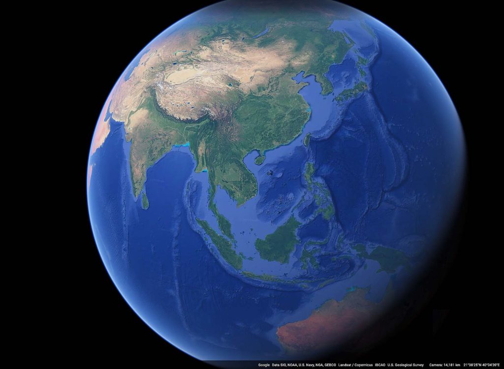
1. Google Earth relies on satellite imagery.
Without satellites, Google Earth’s 3D representations of the world wouldn’t be anywhere near as impressive. Specifically, Google’s technology combines photos taken by satellite and aerial photography.
This all adds up to an immersive experience – users can explore some of the world’s biggest landmarks and most far-flung places in a matter of seconds.
2. It covers the vast majority of the planet.
Despite only having launched back in 2001, Google Earth currently covers an astonishing 97% of the planet. Admittedly, 3% is still a lot of ground to cover when you consider just how big the world is – but the fact Google has most of it documented is nothing short of staggering.
Not only that, but Google Earth can overlay different types of maps and topography so you can take an even deeper dive into what the world around us actually looks like. It’s not just a feast for geography nerds, either – it’s developed to be easy for people of all ages to explore and manipulate.
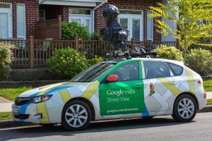
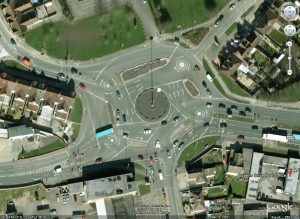
3. Google Street View adds to the depth.
Ever heard of Google Street View? It’s a popular service that allows you to explore specific places across the world as if you’re travelling down a road – it’s a fantastic tool if you’re going somewhere new and want visual directions.
Much of Google Earth is connected by millions of miles of imagery captured by Google’s Street View cameras. At the time of writing, more than ten million miles of data has been collected – all thanks to cameras mounted to vehicles! There’s a chance your house is on Street View – as scary as that might sound…!

4. You can access Google Earth from a variety of devices.
For as complex and as in-depth as Google Earth is, it’s impressively adaptable. You don’t need a supercomputer with stacks of RAM to run the software. In fact, you can simply download the app to your phone or tablet as you wish.
From any of the Google Earth apps, you can explore the planet by entering in coordinates or simply scrolling around. It’s fantastic for kids with geography homework who want to avoid what so many of us went through at school – having to pore through book after book after book! Where was Google Earth when we needed it back in the day?!
5. You can even explore parts of Mars and the Moon.
Google, ever ready to go beyond its boundaries, will even let Google Earth users explore other celestial bodies – should they ever get bored of terra firma!
There are rudimentary (by Google’s standards) globes available for you to explore that let you see the Moon and the red planet up close. Chances are, these virtual globes will become more and more detailed as the years go by, so keep a close eye on Google Earth for the latest findings! You never know – we might find alien life through the app one day!
6. It’s inspired a viral online game.
GeoGuessr, a free online game, is based on Google Earth and Street View. In the game, players start at a random point in the globe and can explore the virtual area – and they have to guess exactly where they are and pinpoint their location on Google Maps. The closer you are to the mark, the more points you get!
GeoGuessr has taken off massively online with its own apps, and has continued to build strong followings on YouTube and Twitch. You can check out GeoGuessr for yourself here.
7. Google works with several major bodies to make its Earth app work.
As you might imagine, Google isn’t solely responsible for all the photography you’ll see through the Earth app. It works closely with the likes of National Geographic and NASA, for example, to bring together accurate imagery and data to help inform its users.
On the Google Earth team, however, there’s only around five people working on user experience at a time – with up to 30 engineers helping to manage the service’s data.
8. People have used Google Earth to prepare for and respond to disasters.
Google Earth isn’t just an educational or exploration tool. In fact, in times of genuine crisis, it’s helped to track the impact of natural disasters.
For example, even as far back as 2005, at the height of Hurricane Katrina, Google was able to update its Earth service with real-time data to help first responders attend to people in need of rescue. The imagery brought together through Google Earth helped users to truly understand the scope of the disaster.
9. It’s helped others to map out their cultures.
Interestingly, some people have even used Google Earth to help map out and establish how far their culture travels across the globe.
Chief Almir of Surui, for example, met with Google in 2007 to learn how to train his people on how to use the software. This led to the Surui tribe creating its own cultural maps – meaning they could track their most important sites across the Brazilian rainforest in real time!

10. Google Earth helps humanitarian efforts to wipe out landmines.
Landmines claim thousands of lives every year – which is why organisations like the HALOTrust started using Google Earth to map out broad landmine areas for clearance.
HALO cleared almost two million landmines at the time of writing and continues to use Google Earth to map out areas of interest where lives might be at stake.
11. You can explore the sky above us, too.
If exploring Earth, the Moon, and Mars wasn’t enough, Google Earth even lets you cast an eye to the sky, too – with its aptly named Google Sky feature.
This lets you take a closer look at stars and constellations, thanks to the help of telescope technology. In fact, it’s thanks to the Hubble Space Telescope that the service has so many detailed images!
Google Sky also continues to bring together fascinating data such as far-flung galaxies and even animations of how certain bodies orbit each other.
12. Some even use Google Earth to monitor traffic.
If there’s one thing that so many of us try to predict with varying levels of success, it’s the traffic. However, thanks to GPS data provided through Google Earth, it’s never been easier to plan your route to and from work.
You can monitor current traffic patterns, in fact, through the Google Maps app – and much of the viewable data is actually provided by users of the service!

13. Users have spotted ancient wheels etched into the planet!
If you thought crop circles were strange, you’ve yet to explore Google Earth to its fullest. For example, out in Jordan’s Azraq Oasis, you can see strange spoked circles that experts believe date back for thousands of years!
Archaeologists have continued using the service to spot even more ancient geometric shapes carved into the ground, too. They’ve even spotted squares and triangles – but why are they there?
Some believe it’s to do with the Winter solstice – but regardless, they’ve fascinated many thanks to their age alone – they’re said to be some of the oldest geoglyphs on the planet.
14. There have been strange cases where territories have… disappeared.
Yes, weirdly enough, it’s entirely possible for islands to appear on Google Earth, only to completely vanish in person. But how? Yes – mistakes can be made – but GE’s incredible accuracy means that’s hardly likely in practice.
In 2012, researchers based in Australia found that a territory called Sandy Island – which had been found on physical maps as well as Google Earth – no longer existed when they went to find it in the South Pacific on a physical expedition. Only open water remained – could the location have been artificial?
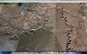
15. Some have been lucky to spot curious animal markings.
As strange as it may sound, Google Earth has even helped people to find odd markings left behind by ants! Specifically, dotted patterns spotted in the software around the Grand Canyon are easy to see in Google Earth – and these are, supposedly, thanks to the work of minute ants.
Specifically, the area around Vulcan’s Throne, a volcano, is home to scores and scores of red harvester ant nests. On Google Earth, these appear in curious dotted patterns! At least, that’s the assumption – research is ongoing.

16. You can even see hidden messages.
Ever wanted to have so much money that you could write your name in the ground so it’s visible from space? No? Well, you probably won’t have the same priorities as billionaire Sheikh Hamid bin Hamdan al Nahyan.
Specifically, if you navigate toward al Futaisi Island in the Persian Gulf, you’ll see the name HAMAD carved out in the sand from hundreds of miles up. The name is around two miles long, and around a half a mile in height. And no, the letters aren’t likely to wash away – they’re so massive, they absorb water!
17. Advertising is even possible through Google Earth.
Is there anywhere that isn’t ripe for advertising space these days? Maybe not – and certain areas of Google Earth aren’t excluded from that.
Believe it or not, huge advertisements for the likes of Coca Cola and KFC have been created so they’re visible from satellite. Head to a certain Chilean hill, and you’ll be able to see a huge advert for the former made out of empty bottles.
18. Conservation efforts are strengthened through Google Earth.
If you’re lucky enough, you might spot Google’s satellite images having captured wild animals moving in packs – elephants, for example, can be tracked in real time!
In fact, this has helped several conservation efforts in monitoring and protecting elephants from ivory poachers. It turns out it’s easier to see where they’re travelling from above!


19. You can even explore Google Earth through VR.
Virtual reality is here to stay, and of course, it’s possible for you to set foot almost anywhere in the world with Google Earth developed for VR technology. Google Earth VR was first launched all the way back in 2016, and it’s allowed people to fly across vast expanses they otherwise might not get a chance to see in person!
20. The technology’s helped to inspire several popular games.
Beyond GeoGuessr, technology used to support Google Earth is similarly used by Niantic, the firm responsible for developing 2016’s biggest gaming release – Pokemon Go. The mobile title, which lets you discover and capture fictional creatures in the wild, is still going strong today.
Google Earth itself even supported an interactive game of its own back in 2019, tying in a series of challenges with the much-loved Where On Earth is Carmen Sandiego series – which revolves around a slippery thief extraordinaire.
21. The age of imagery on Google Earth varies.
As mentioned, there are use cases where people can view movements in real-time – such as for traffic updates and monitoring animals – but in many cases, images are a few years old.
Much of this is to do with privacy – no one wants people to be able to log into Google Earth and spy on them in real-time! Google’s street cameras roam the roads and avenues to take static images, which are refreshed every so often.

22. People’s faces are blurred out.
Occasionally, Google Earth and Street View might capture someone going about their daily business! Don’t worry if you get captured, however – the service endeavours to blur out everyone it accidentally captures. What’s more, it also blurs out car number plates and other sensitive information.
23. An international incident was once averted – after someone raised an alert thanks to Google Earth!
As detailed as Google Earth can be, it’s sometimes easy to make mistakes from a distance. For example, when a series of satellite images merged into Google Earth over in the Chinese desert, a CIA analyst started to get concerned.
The analyst believed they’d spotted suspicious structures – which others soon suggested might have been used for military purposes unknown to the western world!
However, the buildings were later analysed in more detail – they don’t appear to be anything to be worried about. In fact, it’s assumed that they might simply be manufacturing siloes!

24. Vostok Island is completely blacked out… or is it?
Let’s end with something of a mystery – the curious Vostok Island, a land mass in the middle of the Pacific Ocean, is completely blacked out by Google Earth. What could this possibly mean? It’s thought to be uninhabited!
Conspiracy theorists suggested that the island may have been a secret base – but in reality, it seems that the island’s thick forest foliage and soil actually make it look like it’s been blacked out from a distance! So, there’s a perfectly logical, natural explanation – no underhandedness here, at least!
FAQs About Google Earth
Can I use Google Earth without downloading it?
Yes, you can use Google Earth from your web browser. You can do so via laptop, desktop PC, and handheld devices. Just head to https://earth.google.com and start exploring! For the most advanced features and accessibility, however, I’d recommend you download the official app for a phone or tablet.
Is Google Earth still free to use?
Yes, you can still access Google Earth for free at the time of writing. You can either visit the software’s website to run it in your browser, or download a free app for your chosen device.
Is it legal to use Google Earth?
Yes, provided you are using the software for legal purposes as outlined in Google’s terms of use and service, you can use the service without worrying about repercussions. Always make sure to read any terms you’re provided with carefully before agreeing to them!
Do you know any interesting facts about the Google Earth? Share them in the comments below!